

Ryan Reynolds, MGIS, Ph.D.
Principal Researcher / Developer
Dr. Reynolds’ research aims to help Canadian communities and households better understand, prepare for, and respond to local hazard risks. His work combines geospatial modelling and analysis, mapping, risk communication, and application development at national, provincial, regional, community, and neighbourhood scales.
Ryan holds a Master’s in Geographic Information Systems (MGIS) focused on public participation GIS and a Doctorate in Geography focused on tsunami risk and evacuation modelling from the University of Calgary in Alberta. He also held a Postdoctoral Research and Teaching Fellowship with the School of Community and Regional Planning (SCARP) at the University of British Columbia in Vancouver, where he explored coastal hazard risk across Canada while developing the Resilient-C Platform.
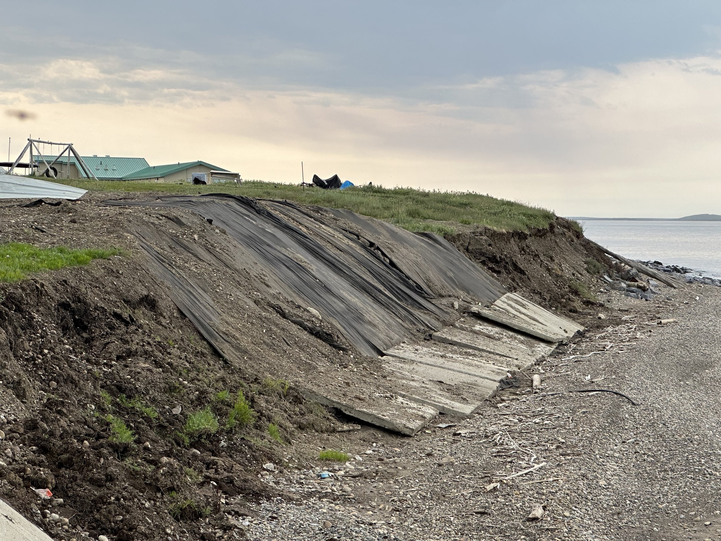
Before forming Resilience Mapping Canada, Ryan was a Coastal Risk Analyst with the Geological Survey of Canada within Natural Resources Canada (NRCan). He worked on three case studies for the Pacific, Atlantic, and Arctic oceans. His primary focus during this time was assessing the impacts of coastal storm surge and sea-level rise scenarios for the Hamlet of Tuktoyaktuk in the Northwest Territories. While at NRCan, Ryan received his certificate for the Principals of OCAP from the First Nations Information Governance Centre and completed The Path from the NVision Insight Group to better understand and advocate for Indigenous inclusion in hazard risk studies and to ensure that Indigenous communities continue to hold ownership, control, access, and possession over data collected for their communities.
Ryan’s Recent and Ongoing Work
Coastal Storm Surge Flood Risk Assessment
Role: Mapping Lead,
Client: Natural Resources Canada (NRCan)
Ryan completed flood inundation, impact, and damage assessment maps for 24 storm surge and sea-level rise scenarios and was a lead contributor to the final project report.

Hazard Risk and Vulnerability Assessment (HRVA) Story Map
Role: Mapping Lead,
Client: North Shore Emergency Management (NSEM)
Ryan developed an ESRI Story Map to share NSEM’s updated HRVA and associated exposure maps for eight hazards common or likely within the region.

Extreme Heat Vulnerability Mapping
Role: Mapping Lead,
Client: North Shore Emergency Management (NSEM)
Ryan completed the extreme heat vulnerability mapping and exposure analysis for the three municipalities and two First Nations communities on the North Shore.

Disaster and Climate Risk and Resilience Assessment
Role: Geospatial Advisor,
Client: BC Ministry for Emergency Management and Climate Readiness (EMCR)
Ryan was a geospatial advisor to EMCR, the lead project contractor, and other project partners for the production of provincial risk maps.